Hopedale Information


map | elevation profile | demographics
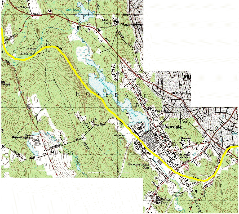
Consisting of just over 3 miles of the railroad right-of-way, Hopedale serves the shortest length of the project. Once connected to Milford across Cape Rd (Rte 140), the Grafton and Upton Railroad Trail projected start begins near Green(e) St at its southern end. (This isn't to say the project ends there. Since there has been remarkable progress on the Upper Charlers River Rail Trail from Milord to Dover, there is a possibility to link the two trails. As this information becomes available, it will be posted.) Following behind homes through woods and with a power line right of way, the railway crosses over Hopedale St on a unique railroad bridge. From there it turns to the north, crosses over Mendon St (Rte 16) to arrive at the Hopedale Depot yard, just outside the center of town. The rail bed continues over the Mill River and behind the Draper Complex that once built most of the world's textile looms. It crosses Freedom St after passing by Draper Field and continues for another mile north through the Hopedale Parklands beside Hopedale Pond before entering Upton and parts of the Upton State Forest.
Now on the National Register for Historic Places with the National Park Service, the Town of Hopedale is rich in history; from its roots as a religious commune to an industrial company town. The railroad's largest customer, and owners for almost eighty years, the Draper Corporation, contributed much to the town over its history.
With an open, much unused area at the bottom of Depot St behind the railroad's depot building, Hopedale has a great site for a trail interpretation/visitor center, parking, and vending along the proposed trail line. In addition to the depot, the area also houses more than one piece of Grafton & Upton rolling stock, a railcar scale building, and a small bridge over the Mill River.
Below you will find a map of the Hopedale section of the project, demographic information on the town, and other information of local interest.
Click anywhere on the Right-of-Way (yellow line) below to get detailed pages of interest.
Not all links are currently available. Please check back after 12/3 for more information. Thank you.
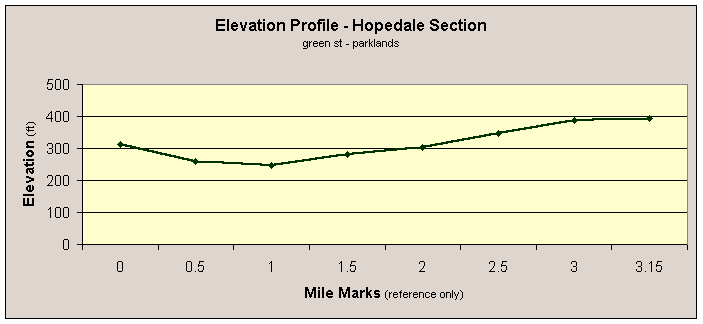
On the right you will find the elevation profile for the Hopedale section
of the railroad from south (Green(e) St) to north (Hopedale
Parklands).
The overall elevation gain from one end of the town to the other is 81 feet, or roughly .4%.
From Hopedale Depot (the town's point of lowest elevation) to the Mile Marker 3 (as shown in this graph), the elevation change was 141 feet, a very gradual 1.3% incline.